
Salmon-Bitterroot Country: Montana: USA
 Salmon-Bitterroot Country High in the Rocky Mountains of Idaho and Montana, this winding drive tours sharp-edged peaks and swift rivers. The ancestral home of two Indian tribes, the Shoshones and Flatheads, the Salmon and Bitterroot valleys witnessed an influx of adventurers in the 1800s — from trappers, mountain men, and gold and silver prospectors dreaming of riches to cowboys hoping only to survive the winter. No matter who has come and gone, the remote backcountry remains an inspiring realm, with roiling rivers, craggy peaks, and far-off vistas that lure you ever onward.
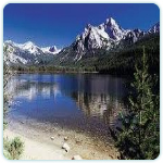
Stanley Looking just as jagged as their name implies, the Sawtooth Mountains form a striking backdrop for Stanley, a throwback to the Old West, where the citizens take pride in a relaxed boots-and-jeans lifestyle. The Salmon River, the longest free-flowing waterway in the lower-48 states, passes right through town. Rte. 75 follows the river, which snakes out of the Stanley Basin between high cliffs. Douglas firs and other conifers predominate in the forests, but aspens appear here and there as well, brightening the mountains’ evergreen slopes with autumnal splashes of gold.
Sunbeam Once in the town of Sunbeam, you’ll notice the ruins of an old dam. The only such structure ever built on the Salmon River, it was erected in 1910 to supply power for a nearby mill and mines. Since it prevented salmon from swimming upstream to spawn, however, residents agreed to circumvent it, and in 1934 a well-placed charge of dynamite once again unleashed the river’s flow. Partially unpaved forest roads lead north out of Sunbeam to two early gold-mining camps, Custer and Bonanza. Both communities boomed when rich veins of ore were discovered around 1875, and both were all but abandoned by 1911. Sightseers can explore the ghost towns, where dance halls once resounded with rollicking piano tunes. A museum in Custer’s old schoolhouse tells the story of those earlier days.
Challis The drive to Challis, a small town with lodging and services, offers many opportunities to observe the region’s wildlife. At Indian Riffles, for example, an overlook on Rte. 75 offers views of spawning salmon in the fall. The road then heads east and north, never straying far from the river. Along the way, you might spot dippers, aquatic birds that resemble chubby brown wrens. Overhead, golden eagles sail across the sky, their graceful flight a nearly perfect symbol of the freedom one finds among the Rockies. The area is also inhabited by bighorn sheep, which winter on the alpine slopes, and mountain goats, sure-footed creatures that roam the uppermost cliffs at will.
Cronks Canyon By the time the drive reaches the town of Ellis, low bare hills give way to the steep walls of Cronks Canyon. Farther along, the landscape opens once again, and farms and ranches abound. Keep an eye out here in springtime for Idaho’s state bird, the mountain bluebird.
Salmon Hemmed in by sheer cliffs, the dangerous, churning rapids of the Salmon River — a powerful torrent that the Shoshone tribe believed no human could survive — have earned the waterway the nickname River of No Return. Eventually, however, boatmen learned to master its white water, and today thrilling raft trips and jet-boat tours are available. Surrounded by tall mountain ranges, the town of Salmon is also the home of the Sacajawea Interpretive and Education Center, celebrating the Lemhi-Shoshone woman who served as interpreter for Lewis and Clark as they crossed the Bitterroot Mountains. A one-mile-long walk brings her historic culture to life. White-water outfitters offer a variety of trips, which range in length from a few hours to several days. Despite the remoteness of the setting, a day spent shooting rapids ends not with a can of beans but with a sizzling steak at a comfortable camp under the stars.
Lost Trail Pass After being told by Shoshone Indians that the Salmon River could not be navigated, the explorers Lewis and Clark decided to scale this pass on September 3, 1805. What they encountered was by no means a leisurely hike. In fact, one member of the party described their route as ”the worst … that was ever traveled.” Today, following in the footsteps of Lewis and Clark, Rte. 93 zigzags up through dense forests and then, cresting at about 7,000 feet, descends into Montana. Farther along, the East Fork of the Bitterroot River comes into view, its chilly waters rushing to the valleys below.
Bitterroot Range The byway continues through a fairly narrow valley, which eventually widens to permit glimpses of the Bitterroot Range to the west. Bitterroot, the plant that gave these mountains their name, once was a staple food of Indians, who boiled or baked the roots to lessen the bitter taste. Today it is Montana’s state flower, and locals cherish the lily’s pinkish bloom as a sure sign that spring has come. Other plant life includes towering ponderosa pines, cedars, firs, and larches, all of which blanket the lower slopes of the Bitterroots. The mountain crests, however, remain bare, their granite crowns battered by the elements into knife-edged horns and aretes. South of the town of Darby, Trapper Peak rises some 10,157 feet.
East Side Highway Near Hamilton, towering cottonwoods arch over the Bitterroot River, which meanders gently now after its tumultuous fall from the highlands. Exit onto the East Side Highway (Rtes. 269 and 203), which ventures to two noteworthy sites. The first is the Daly Mansion, a 42-room showplace begun in 1897 by a mining magnate. Then, at Stevensville, the highway nears the Lee Metcalf National Wildlife Refuge, where ospreys are making a welcome comeback.
Travelers Rest Historic Site Before heading west for the Bitterroot Mountains and Lolo Pass, Lewis and Clark camped at this site just off Rte. 93. Nine months later — their trail-blazing journey nearing completion — they bivouacked here again, then returned to St. Louis and the heroes’ welcome they so richly deserved.
In Flathead Indian Country Cradled between the sky-high peaks of the Rocky Mountains, the broad valleys of Flathead Country unfold as a patchwork of golden hayfields, rolling rangeland, and fragrant cherry orchards. Montana may be known as Big Sky Country, but in the state’s rugged northwestern corner, the landscape looms just as large. Like the cowboys, prospectors, and pioneers who staked their claim to its riches, nature exists on an epic scale in Flathead Country — where the mountains seem the highest, the valleys the broadest, the rivers the wildest, and the lakes the bluest of blue.
Missoula A brawny western town, Missoula sits in a fertile basin where the Clark Fork, Bitterroot, and Blackfoot rivers converge. Through the years the site has served as a natural thoroughfare — first for Salish Indians and much later for travelers on the Northern Pacific Railway. Despite a devastating fire in 1884, much of historic Missoula remains. The old downtown district on the north side of the Clark Fork showcases many lovely old structures. Across the river the University of Montana, a major research institution, is surrounded by leafy blocks of lavish 19th-century homes. Missoula’s mile-long Greenough Park provides a refreshingly scenic hike through stands of conifers and cottonwoods lining the banks of Rattlesnake Creek. Bird-watchers gather here to glimpse warblers, pileated woodpeckers, American dippers, Bohemian and cedar waxwings, and other avian rarities.
Flathead Indian Reservation Traveling northwest from Missoula on I-90, the drive traces the Clark Fork for eight miles through grassy bottomland and then turns sharply north on Rte. 93, where it begins to climb. Seven miles later — and about a thousand feet higher, amid forests of Douglas fir and ponderosa pines — you arrive at Evaro and the southern boundary of the Flathead Indian Reservation. Home to more than 5,000 Indians, the reservation encompasses over 1.2 million acres, including much of the valleys to the north and the mountain ranges on either side. From Evaro, the road descends into the Jocko Valley to Arlee, site of the largest powwow in the northwest, held every summer in July. From there a short, steep climb leads to a turnout with an eye-popping view of the Mission Mountains. Reaching 10,000 feet, these stunning peaks form a barricade of ice and stone that seems to launch skyward from the valley floor. So protected is Mission Valley that the Indians knew it as the “place of encirclement.”
St. Ignatius Mission As early as 1840, Jesuit missionaries — known to Indians as Black Robes — visited western Montana, choosing this hillside spot to build their mission in 1854. The structure’s plain brick exterior gives little hint of the beauty to be found within; about 50 murals and frescoes with biblical themes adorn the walls and ceiling.
National Bison Range Backtracking five miles south on Rte. 93 to Ravalli, take Rte. 200 west to Rte. 212, then head north to Moiese, the starting point for a drive through the National Bison Range. Once darkening the plains by the millions, these splendid beasts were the victims of wholesale slaughter in the 19th century. Today relatively few remain, but their numbers are growing, and the National Bison Range is a cornerstone of these restoration efforts. A 19-mile auto tour weaves through a rich pastiche of high-country landscapes — swirling grasslands, timbered hillsides, streamside groves — where bison and a variety of other wild animals live.
Ninepipe National Wildlife Refuge Continuing a few miles farther north on Rte. 212, you will reach the Ninepipe National Wildlife Refuge. It encompasses a wetland habitat of marshes, reservoirs, and glacial pothole ponds that each year attract more than 200 species of birds. A viewing site on the east side of Ninepipe Reservoir offers some of the most fascinating viewing, especially in the spring and fall, when the refuge serves as a stopover for migrating flocks.
Polson Famous for its cherry orchards, Polson sits atop the rough glacial moraine fronting Polson Bay, at the southern end of Flathead Lake. It’s an energetic town, with a busy waterfront of shops, restaurants, and docks that is perfect for an afternoon stroll. At the bay’s southwestern corner, the lake drains into the Lower Flathead River, which runs into a canyon plugged at one end by the Kerr Dam — a spectacular concrete edifice that measures 204 feet in height. To reach the dam, which is two miles downstream, head west on Seventh Avenue to Kerr Dam Road and follow the signs; a long flight of steps leads to a lookout point above the dam with bracing views of the Lower Flathead canyon, a landscape where roiling rapids contrast with arid hills that are virtually inaccessible by road.
Flathead Lake First visible from the top of a gentle rise near Polson, Flathead Lake is the largest natural freshwater lake west of the Mississippi, and one of the loveliest. Embraced by rolling hills, deep green forests, and snowcapped granite peaks, the lake recedes 28 miles into the distance, where its shining surface mingles with the sky. Wooded islands and white sails dot the surface; tidy coves, rocky points, and picturesque camps line its shores. Like the glacier that created it some 12,000 years ago, Flathead Lake leaves an indelible impression on all who behold it for the first time. Heading northwest from Polson, Rte. 93 cuts briefly inland across grassy hills and then rejoins the lakeshore at Big Arm. At the town marina you can rent a boat for a trip to Wildhorse Island, just offshore. After arcing around westward-pointing Big Arm Bay, the road heads due north, hugging the lake’s ragged shoreline for about 15 miles. Evergreen forest marches straight to the water’s edge, and toward sunset the Mission Mountains to the west drape long shadows across its surface.
Lake Mary Ronan Lake Mary Ronan may seem positively petite — and pleasantly secluded — compared to immense Flathead Lake. To reach it, take the turnoff in Dayton; then follow the signs for a short, three-mile trip on paved and gravel road to the lakeshore, hemmed in on all sides by a close, hilly forest of ponderosa pines. At dusk the only sound you are likely to hear is the splash of jumping trout and salmon, which reach record sizes in these protected mountain waters.
Lone Pine State Park A pretty state park with trails that wind through wildflower meadows and forest glens, Lone Pine would be worth a stop even if it didn’t offer some of the most arresting views in Flathead Country. From the visitor center a loop trail leads to three cliffside lookouts whose commanding perspective stretches from Kalispell to the jagged peaks of Glacier National Park, serrating the horizon.
Kalispell Situated on grassland within sight of Swan Peak and the Whitefish Range, the town of Kalispell stands as a living monument to the entrepreneurial spirit and good timing of one man, Charles Conrad. His Virginia plantation lost in the Civil War, Conrad headed to Montana, establishing a successful freight operation. In the process he amassed a considerable fortune, but restlessness got the better of him; on a tip from the head of the Great Northern Railroad, Conrad took a chance and moved his enterprise to the Flathead Valley. When the railroad arrived in 1891, Conrad was waiting, and Kalispell was born. Since those days Kalispell has served as the northern Flathead Valley’s unofficial capital. The Conrad family mansion, on Woodland Avenue, is the city’s showpiece. An elegant Norman-style home with 23 rooms decorated in period furnishings, it abuts a picturesque city park with rose gardens and a duck pond, part of the original Conrad estate.
Whitefish Fifteen miles north of Kalispell, Whitefish is home to Montana’s largest ski resort, 7,000-foot Big Mountain. The peak lures visitors in the warm months too, when its slopes are dressed with wildflowers and the views from up top stretch all the way from Flathead Lake to southern Canada. A gondola will whisk you swiftly to the summit, or you can take a “Walk in the Treetops” at Big Mountain on platforms and paths 30-60 feet high, in a canopy of fir, cedar, and tamarack. At the foot of the mountain, Whitefish Lake stretches seven miles into Flathead National Forest. The town of Whitefish, on the lake’s southern tip, touts itself as the “recreation capital of Montana” and hosts one of the state’s most exuberant winter carnivals, held each February.
Hungry Horse Dam How they survived is a mystery, but when a pair of freight horses wandered away from their logging team during the winter of 1900-01, they headed straight for the pages of history. Found a month later in chest-deep snow, the two were half-starved but otherwise none the worse for the wear — prompting the comment that this was the “mighty hungry horse country.” Just as marvelous as their tale of survival is the Hungry Horse Dam, an arched wall of concrete 564 feet tall and about 2,000 feet across, capable of producing enough electricity to light a city five times the size of Missoula. Behind the dam, 34-mile-long Hungry Horse Reservoir reaches deep into backcountry forest. Encircled by a gravel road, the reservoir is flanked by the Great Bear Wilderness and Jewel Basin Hiking Area.
Swan Valley Heading south, the drive passes through the village of Bigfork, heads east on Rte. 209, and turns south onto Rte. 83 — a beautiful stretch of road that, for more than 90 miles, parallels the Swan and the Clearwater rivers before terminating at Clearwater Junction nearly due south. Presided over by the stony peaks of the Swan Range to the east and the Mission Range to the west, the highway seems to meld gracefully with the idyllic wilderness that surrounds it. The Swan River National Wildlife Refuge, at the southern tip of Swan Lake, is but one of several pleasant stopping places along the route, and it promises superb wildlife watching. In this undeveloped tract of swampland and lakeshore, keep alert for signs of moose, bears, tundra swans, and bald eagles.
Holland Lake It’s hard to say precisely what makes this small body of water so special. Perhaps it’s the lake’s remoteness; perhaps, too, it’s the unassuming beauty of the place, the utter calm of the lake’s blue surface in the mists of dawn or the blaze of an evening sunset. Located at the edge of the vast Bob Marshall Wilderness Area, Holland Lake also serves as a trailhead for one of the most popular hiking and horseback riding routes into this immense natural reserve. Larger than the state of Rhode Island, “the Bob” (as it is known locally) straddles the Continental Divide and embraces almost 2 million acres of forest.
Seeley Lake Area Flowing south to the Blackfoot, the Clearwater River forms a chain of picture-perfect lakes — Alva, Inez, Seeley, and Salmon — with wide-open views of the Mission and Swan mountains. A unique way to explore the area is by taking the Clearwater Canoe Trail, a three-mile downstream float with a one-mile hike back to the put-in point. Splendid by day, the ride is doubly so at dusk, when loons suffuse the air with their tremulous cries. Farther on, the drive turns west on Rte. 200 at Clearwater. It then returns to Missoula via the Blackfoot River corridor, the locale celebrated in A River Runs Through It, Norman Maclean’s memoris of his boyhood in Montana.
Going-to-the-Sun Road Twisting and turning as it climbs through the mountains of northwestern Montana, this drive reveals the wild and wondrous essence of Glacier National Park. At the first signs of spring, workers begin to clear the snow — up to 80 feet deep in places — from Going-to-the-Sun Road, a job that takes two months to complete. The time and effort prove worthwhile, though, for when traffic finally begins to flow, visitors are treated to a nonstop show of stirring views. Most who make the trip will be inclined to agree with Glacier’s founding father, who dubbed the park the Crown of the Continent.
Lake McDonald Before heading into the heart of the park, you might want to acquaint yourself with some of its plants and animals, which are featured in exhibits at the Agpar visitor center. Thus informed, you can be on the lookout for the real thing as you set out on Going-to-the-Sun Road. For 10 miles or so, the highway hugs the once wooded shore of Lake McDonald, the site of forest fires in 2003 that charred many of the trees on its opposite shore. Leaving the lake, the drive tunnels through a forest of mountain hemlocks and red cedars as it begins its climb beside McDonald Creek. Along the way, it passes McDonald Falls, where a thunderous roar heralds a stunning view of the cascade. Just beyond lies a marshy area frequented by moose.
Trail of the Cedars Thick stands of moss-draped hemlocks and fragrant cedars cast a cool shade across this half-mile elevated boardwalk that winds through an ancient forest. Myriad ferns and mosses, glistening with dew, flourish on the forest floor, and at the eastern end of the trail, the faint murmur of Avalanche Creek, slipping through a small gorge, lends a musical note. Be on the alert along streams for a glimpse of the water ouzel, or dipper, a small slate-colored bird that walks underwater in its search for food. Listen, too, for the haunting calls of the varied thrush, especially in the moist forests along the two-mile trail leading to Avalanche Lake. At the path’s end half a dozen waterfalls, dancing down 2,000-foot cliffs, drain into the sparkling lake.
Garden Wall As the road begins its steady ascent, the cedars and hemlocks give way to scattered stands of spruces and firs. Once past Red Rock Point, you may gasp as the Garden Wall first comes into view. A sheer ridge cresting thousands of feet above, its spine makes up part of the Continental Divide. Water falling to the west of the divide drains toward the Pacific; to the east it flows toward the Atlantic. A fire in 1967, sparked by lightning, blazed through the woodlands in this area. Reduced to mere matchsticks, the charred skeletons of trees now punctuate the slopes, which are turning green again as shrubs and fledgling pines make a comeback, reclaiming this rugged, once-devastated landscape.
Birdwoman Falls Just beneath the Garden Wall’s great shadow, the drive meanders along a lengthy zigzag known as the Loop. Climbing ever higher into the thinning air, it arrives at a landscape of waterfalls, peaks, and plunging valleys. Perched above the timberline, this realm boasts many wonders, including Birdwoman Falls. Two miles farther along lies Weeping Wall, where several streams descend a craggy cliff.
Logan Pass The drive’s pinnacle at 6,646 feet, Logan Pass is a high point in terms of scenery as well, with massive domes and spinelike ridges looming boldly above the alpine wilds. A stunted forest of contorted firs marks the timberline, but the open slopes and meadows beyond are awash in summer in a sea of wildflowers. Yellow glacier lilies pushing through the last patches of snow are among the showstoppers, along with shooting stars, Indian paintbrushes, and stately wands of beargrass topped with bold clusters of white flowers — airy snowballs that sway in the breeze. Trails begin and end at the visitor center at Logan Pass, including a boardwalk that wends through a lovely area called the Hanging Gardens. Here as elsewhere at Glacier, remember to scan the surrounding slopes for glimpses of one of the park’s signature creatures, the shaggy mountain goat.
Jackson Glacier Overlook This scenic viewpoint, one of many in the park, affords a splendid view of the frozen, gray-blue mass of Jackson Glacier. Jackson, like the 50 or so other glaciers in the park, is but a feeble reminder of the stupendous ice-age glaciers that shaped so much of this region’s stunning scenery many years ago.
St. Mary Lake Aspens, alders, and birches, their leaves green in summer but golden in the fall, line the road as the drive descends toward St. Mary Valley and its namesake lake. For one of the best roadside views of this mountain gem, pull over at the Wild Goose Island Overlook. Named for a pair of geese that once nested on its shores, the little island seems to float on the otherwise uninterrupted surface of St. Mary Lake. Cresting in the distance is another unusual sight — Triple Divide Peak, which forms part of the Continental Divide. Up ahead the views open wide, and meadows of bunchgrass fan across the wilds. At Divide Creek the heart-stirring wonders of the park are left behind as you venture on to the vast plains lying to the east — unless, of course, you succumb to the urge to turn around and travel the drive through Glacier National Park again.